Other Services
Dronemag, DGPR and Lidar — complementary geophysical methods for high-resolution near-surface imaging and terrain mapping.
Low Impact Surveys
Integrated Workflows
Highest HSSE/ESG Standards
Complementary geophysical services
High-resolution data. Low impact. Versatile applications.
Faraday Geophysics complements its seismic offering with a suite of non-invasive techniques — drone magnetometry, ground-penetrating radar and Lidar — to address a wide range of subsurface and surface mapping needs.
Complementary services
Lidar accuracy class
Non-invasive techniques
Field support
Applications
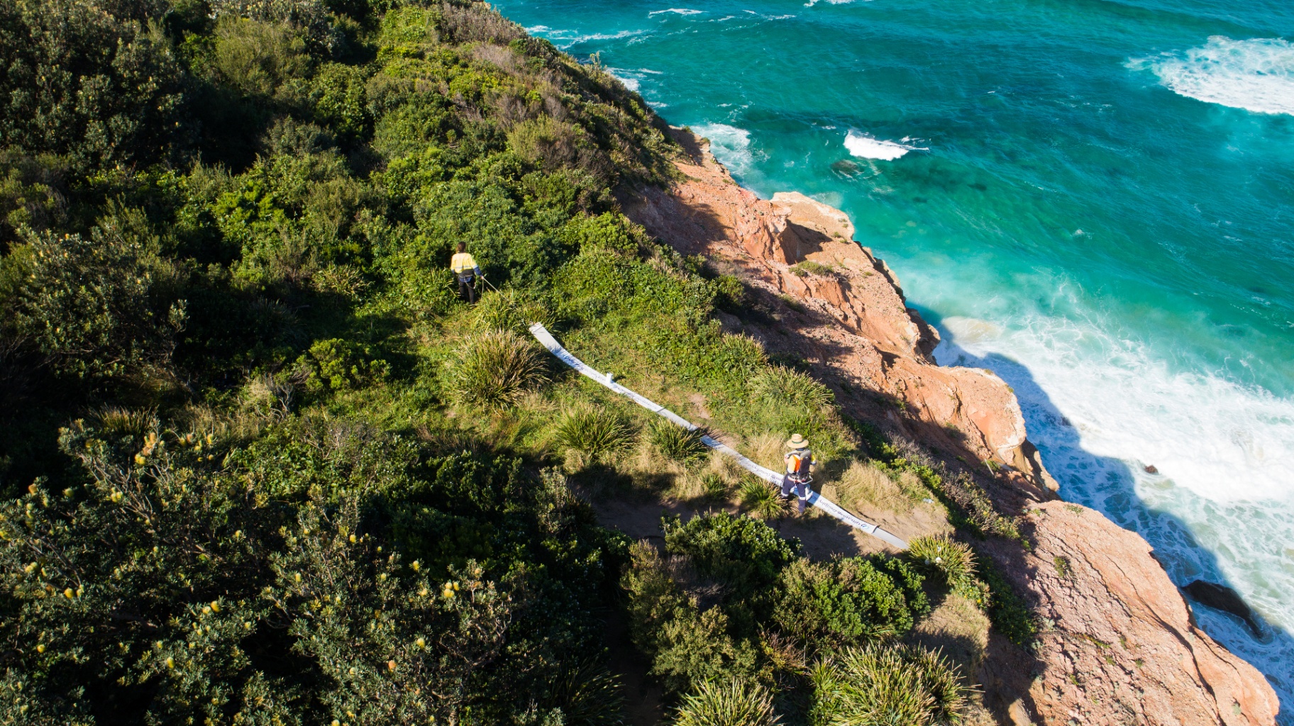
Our non-invasive methods are particularly well suited for projects in sensitive, urban or hard-to-access environments.
From Survey Concept to Subsurface Insight
End-to-end support across the entire project lifecycle.
Why Faraday Geophysics?
By combining advanced technology with experienced field teams, Faraday delivers reliable data that help clients understand the subsurface and make confident decisions.
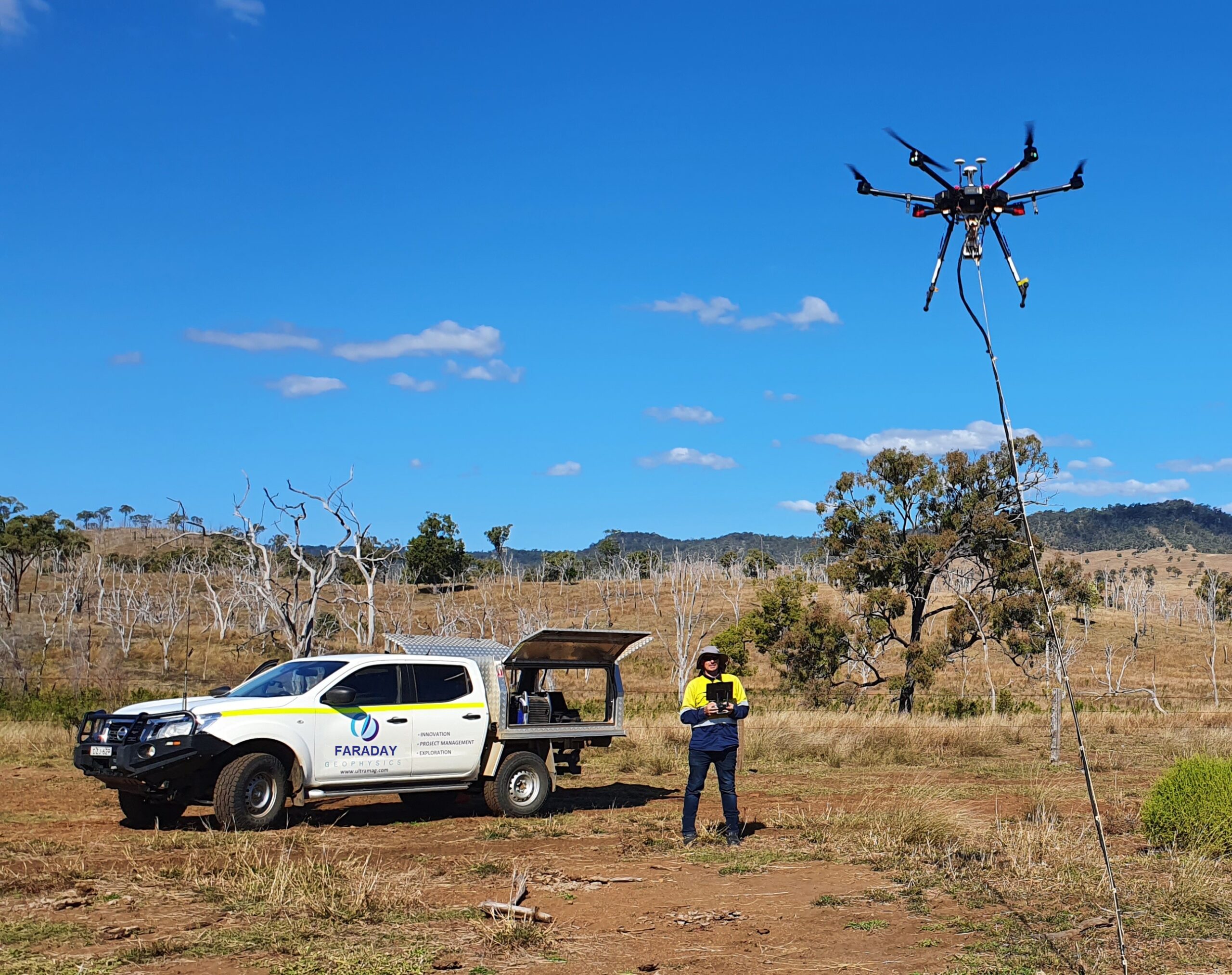
DroneMag
With over 30,000 km of DroneMag survey completed, our experienced DroneMag teams deliver very high-resolution magnetic data, of comparable resolution to groundmag but up to ten times faster acquisition, and at less than half the cost.
Our DroneMag crew can deliver up to 130 km per day.
- High-resolution magnetometer
- Cost-effective mobilization and operation
- Safe and agile
- Fast acquisition
- DroneMag can be used in a variety of applications
Deep GPR
We can image up to a maximum of 100 m depth in ideal conditions, providing the groundwater is not highly saline (conductive). We have 512 channels for each shot. Data is sampled on a continuous basis. Shots are taken every 1–4 seconds, depending on depth.
The antennas can be dragged behind a vehicle, quad bike or manually deployed, depending on the required sampling rate and resolution. The system is capacitively coupled — no electric contact with the ground. Unlike conventional GPR, our transmitting antenna (Tx) has a very short, high-energy pulse. Furthermore, our Tx and Rx are very broadband. We can mix and match antennas and settings to get the best signals for a given target geometry and depth.
- Inhouse developed software
- 15,000 Hz averaged
- 1 sec sample (nominal 0.3–0.5 m shot spacing)
- Infield processing
- 5 m, 10 m, 50 m, 100 m depth settings
- Tx power (10 & 20 kW)
Lidar Services
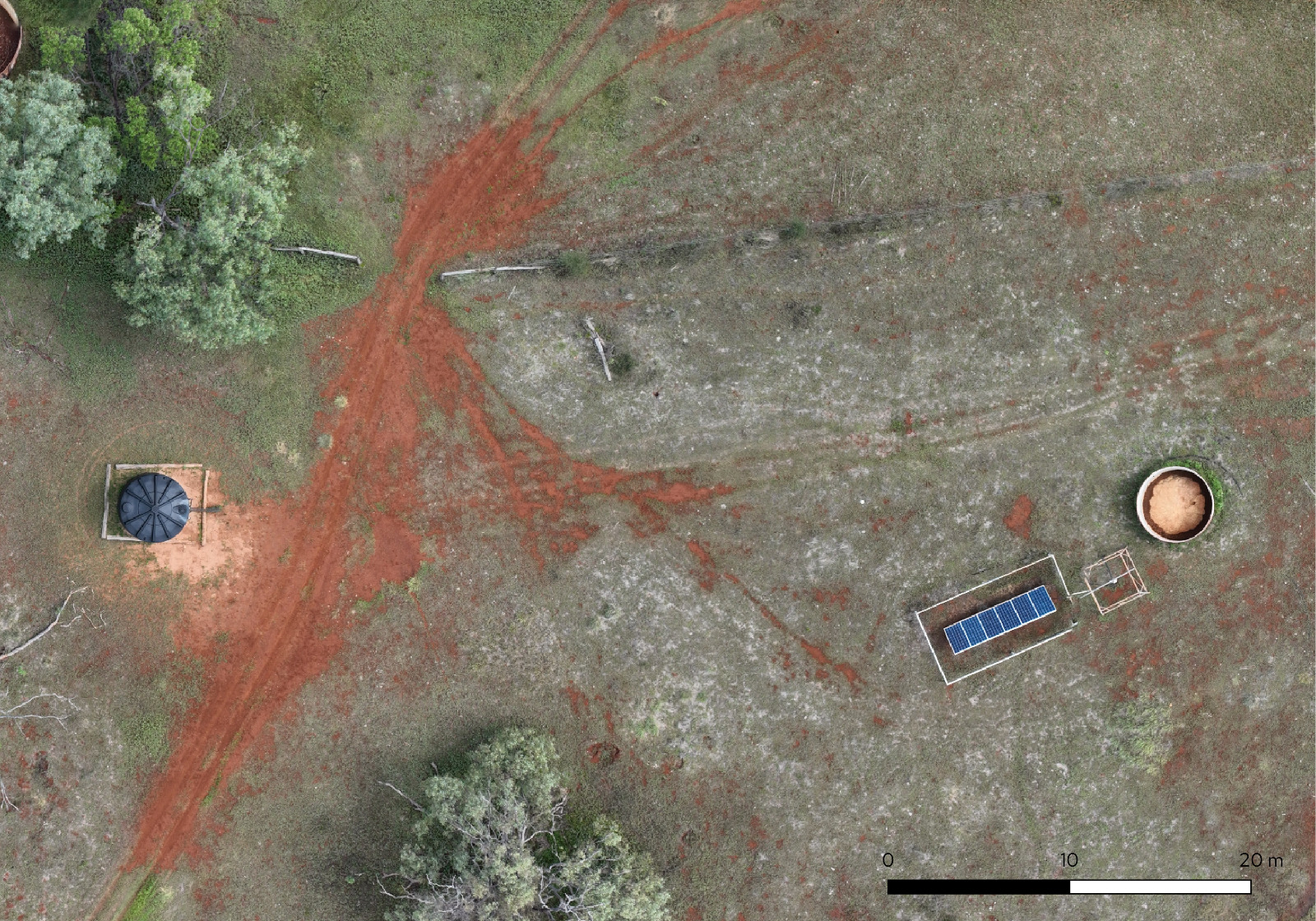
Faraday Geophysics offers high-resolution drone LiDAR data acquisition for rapid topographic mapping across large and inaccessible areas. Our LiDAR service is particularly effective in densely vegetated environments and complex terrain, providing accurate ground models beneath tree canopies and other vegetation while also capturing detailed surface features. Data is collected continuously, producing survey-grade point clouds and detailed mapping outputs.
Our 350 RTK platform combines laser scanning, GNSS positioning and inertial measurement technology to deliver accurate, reliable results. Flight parameters and processing workflows are tailored to individual project requirements to ensure the highest quality outcomes.
- Rapid coverage of large and difficult-to-access areas
- RTK positioning accuracy
- High-density point cloud acquisition
- Vegetation penetration and ground classification
- Digital Terrain Models (DTM) and Digital Surface Models (DSM)
- Colourised point clouds and orthomosaic imagery
Contact
Get in touch
Whether you are planning a new survey or exploring how our eVibe technology can support your project, our team is ready to help.
Europe
+31 40 2180074
Asia Pacific
+61 427 014 002
North America
+1 (780) 876 7337