Seismic Services
Sustainable Subsurface Imaging from Near Surface to Deep Exploration
Clean High Performance
End-to-End Services
Highest HSSE/ESG Standards
Advanced electric seismic acquisition and more
High-resolution data. Lower impact. Deep insight.
Faraday Geophysics delivers high-resolution seismic acquisition using electric vibroseis technology for near-surface and deep exploration imaging.
Imaging depth
Countries
different eVibes for different needs
Applications
Our ability to combine deep imaging capability with a compact operational footprint makes Faraday particularly well suited for projects in complex or sensitive environments.
From Survey Concept to Subsurface Insight
End-to-end support across the entire seismic project lifecycle.
Why Faraday Geophysics?
By combining advanced technology with experienced field teams, Faraday delivers reliable seismic data that help clients understand the subsurface and make confident exploration decisions.
Full Supply Chain Geophysical Services
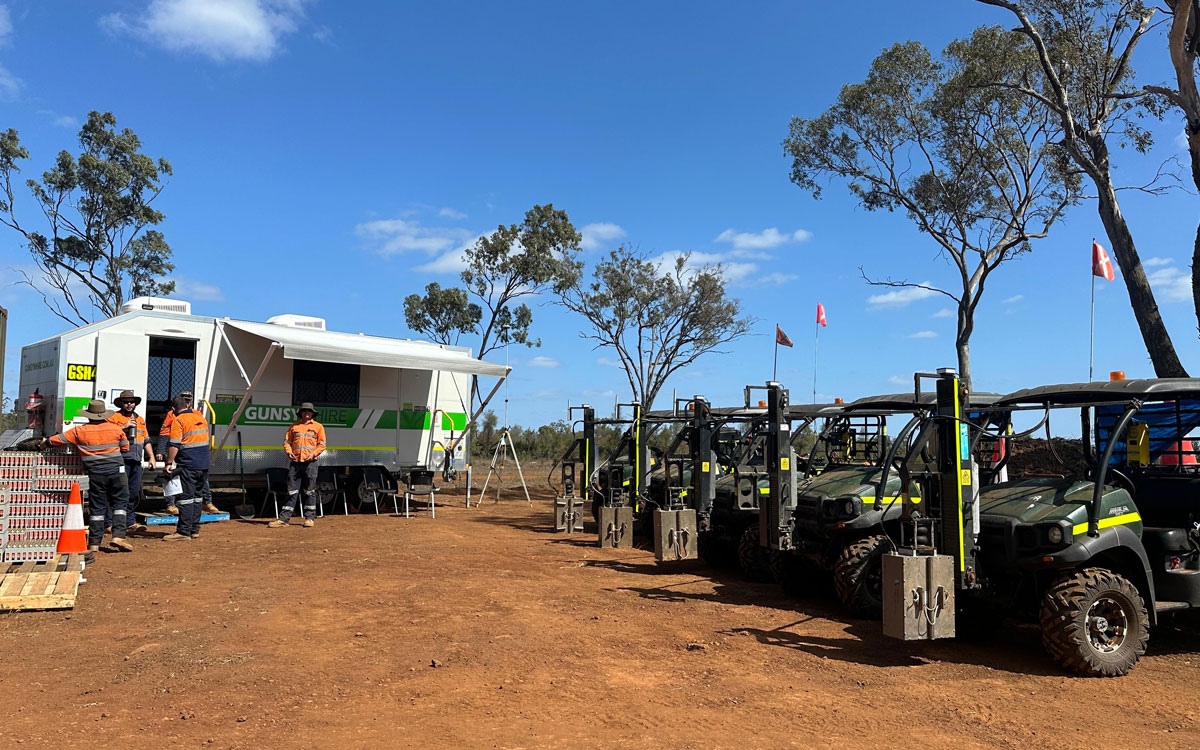
Faraday Geophysics is a mature, full-scope geophysical contractor delivering next-generation ultra high density seismic recording with our electric seismic source technology — the "eVibe" series — designed to meet modern environmental, operational, and data-quality expectations.
Seismic Survey Design
Every successful seismic project begins with careful survey design. Our geophysicists work closely with clients to define acquisition parameters that maximize data quality while meeting operational and environmental constraints.
Survey design includes:
- acquisition geometry optimization
- source and receiver configuration
- modelling of seismic response and illumination
- environmental and logistical planning
The result is a seismic program optimized for imaging performance, operational efficiency, and cost effectiveness.

Seismic Data Acquisition
Faraday provides land seismic acquisition using electric vibroseis systems, including Storm eVibe and Hurricane eVibe technologies, to deliver high-resolution subsurface imaging. These sources generate controlled broadband seismic sweeps that propagate through the subsurface and reflect from geological layers. Services include:
- 2D & 3D seismic surveys
- Nodal acquisition
- Site characterization
- Exploration & appraisal surveys
Our scalable electric vibroseis fleets support both shallow and deep structural imaging to depths beyond 5 kilometres.

Quality Control and Field Operations
Maintaining high data quality during acquisition is critical for the success of any seismic project. Our field teams continuously monitor source performance, receiver response, and data integrity throughout the survey.
Quality control procedures include:
- source performance monitoring
- sweep repeatability verification
- receiver and node diagnostics
- real-time data quality analysis
This ensures that the final dataset meets the project objectives and minimizes the need for costly re-acquisition.
Seismic Data Processing and Imaging
Following acquisition, seismic data are processed and transformed into interpretable subsurface images. Processing workflows enhance signal quality, suppress noise, and reconstruct the geometry of geological structures.
Processed seismic sections or volumes allow geoscientists to identify:
- faults and fracture systems
- stratigraphic layers
- reservoirs and structural traps
- subsurface heterogeneity
These insights help reduce exploration risk and support informed decision-making in exploration and development projects.

Contact
Get in touch
Whether you are planning a new survey or exploring how our eVibe technology can support your project, our team is ready to help.
Europe
+31 40 2180074
Asia Pacific
+61 427 014 002
North America
+1 (780) 876 7337